
Road History

1a. BRIEF HISTORY OF ROADS, TOURISM & TRAFFIC

Old Postcard
A. ROADS
“Boston. Little, if any, urban planning took place. The result is the chaos of today: an exasperating, exhilarating tangle of streets that are a source of pride to those who master them.” - Not For Tourists, Boston Edition (2017)
BOSTON POST ROAD
There is a myth that Boston roads developed from old cow paths. This has been debunked in recent decades by academics. I read the likely explanation for the windy non-grid road system is that roads grew organically over time. Roads were continually being cut to circumnavigate the many hills in the region. This is perhaps why you see seven roads converging into an intersection. This phenomena, which can be seen all over the area, led to the rise of the dreaded rotary. A concise explanation of the evolution of roads can be found in this 2018 Boston Magazine article.

Boston Ways
A book was published in 1957 called Boston Ways. It is the most detailed analysis of early Boston street history I have encountered. It focuses, in particular, on the history of almost every street in Beacon Hill. A 2nd edition was published in the 1960s after many old roads downtown were demolished at the start of the high rise era. It adds new perspective and is also worth a look.
The old Boston Post Road, also known as the King’s Highway, was formerly a well traveled Native American path which became the first colonial era “highway” to Boston. Below is a 1962 print drawn for National Geographic. The road today is Rt. 20 across the eastern half of Massachusetts. When you travel along Washington St. in Brighton or Brookline, you are on the Boston Post Road. Every town in the US has a Washington Street. But this was THE route Washington used when he came to and from Boston.

Boston Post Road (Source: National Geographic)
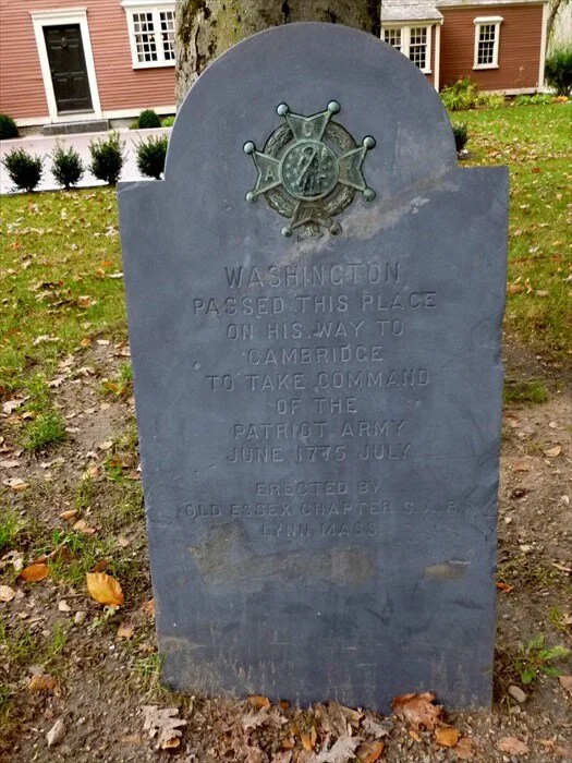
Stone In Sudbury Marking Washington’s Route to Boston
As a road observer I’m always curious about markers by the side of the road. Boston, one of the most historical of all cities, has a multitude markers identifying different people or events. Along the Post Road you can see stones which mark the passing of George Washington as he came to take control of the early militia after the battles at Lexington and Concord. There is a website called Waymarking.com where you can track the location of these (free but registration required). You can also find listings for stones marking the route of General Henry Knox. He made use of early paths hauling cannons all the way from from Ft. Ticonderoga to Dorchester Heights in the icy winter of 1775-1776. This helped Washington lay siege to British ships and forced them to leave on March 17, 1776, Patriots Day.
“Roads. The novice may find himself reduced to tears (pushed to the) side of the road, but the initial challenge makes the eventual mastery that much more satisfying.” - Not For Tourists, Boston Edition (2017)
EARLY MODERN ROADS

Modern turnpikes and roads slowly replaced the old Post Road as horses led to stage coaches, which then led to cars at the turn of the 20th century. Above is a road map of Boston from 1937. There is a Rt. 128 there (you can see it on the left going through Waltham), but it is actually a collection of local roads that encircle the area.
The Boston area prior to the construction of its major highways was more local - sort of the feel you get when you drive out to Western Mass. Going out to Waltham, which according to locals used be a big farming community, was like heading out to the country. The famous old song "Over the River and Through The Wood," published in 1844, is a tale about heading out to gradmother’s house for Thanksgiving, way out in the countryside in Medford. The river is the Mystic River.
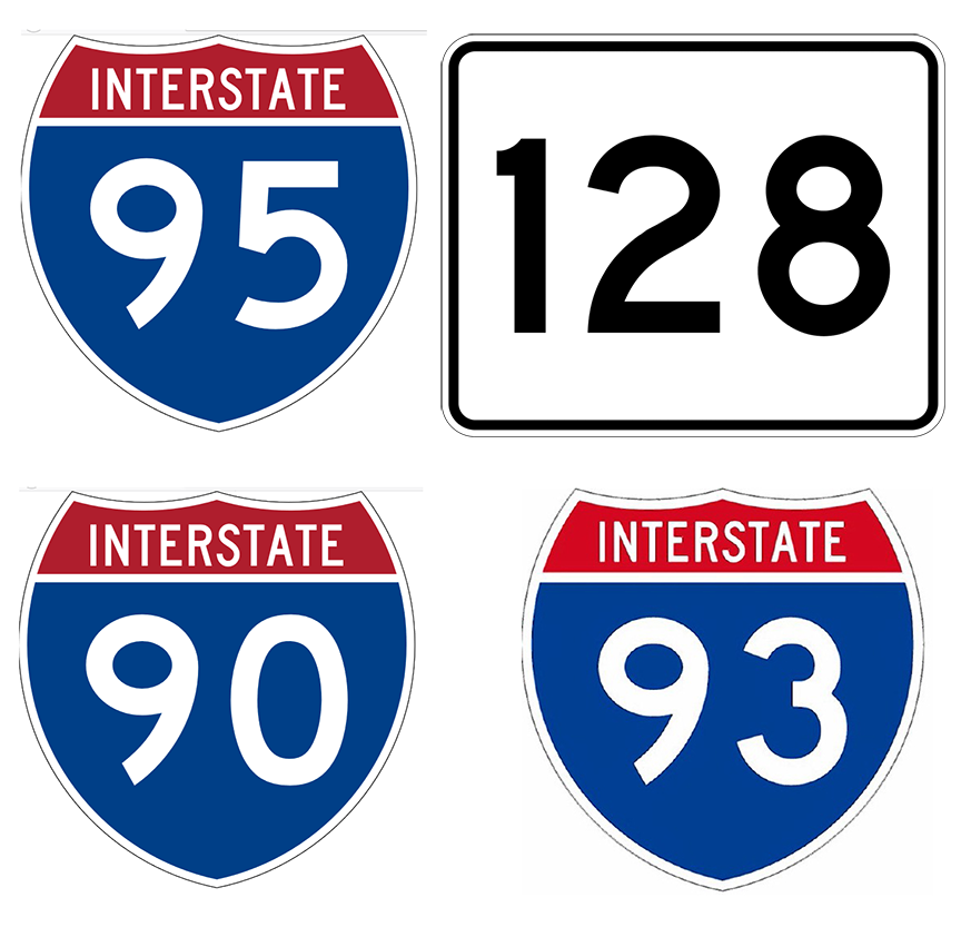
Following WW2 and the return of many soldiers to the area, the use of automobiles began to change this dynamic. The building of the three major highways, I-90, 128/I-95, and I-93 in the 1950s, to accommodate new families and their cars, was the beginning point of the congestion problems we see today.
HIGHWAYS

Mega Cloverleaf, I-95/128 meets Rt. 1, National Geographic 1962
Same Intersection Seen on Waze, 2019
Rt. 128, the Boston Inner Beltway, Boston's so-called "Silicon Valley East” roadway, was started back in the 1930s and completed around 1960. The Massachusetts Turnpike spur, the final portion of I-90 originally finished in 1957, brought the Pike from Weston to downtown Boston and was completed in 1962. The Central Artery Expressway, I-93, with its hallmark overhead highway that snaked through downtown Boston, was finished in the 1950s. Over time, these three roads transformed Boston into a metropolitan city, linked to other east coast cities, and made every town as far out to Worcester a part of the greater Boston area. National Geographic ran a 1962 story on modern roads vs. the old Post Road shortly after 128 was finished.
CENTRAL ARTERY EXPRESSWAY

YouTube Video (Image Source: Boston Globe)
For those who remember the Central Artery Expressway, an overhead highway also known as the Fitzgerald Expressway (named for JFK's father), you remember that there was very little to see downtown because the highway literally cast darkness over many areas including the touristy North End. Ever wonder why there are billboards on top of buildings throughout the downtown area? Now you know. This video is of what things looked like a day before the opening of the Zakim Bridge in 2003 (it starts by coming onto Storrow Drive from Fenway).
“Masshole: From the mouths of out-of-staters, a derogatory term. For a true Boston drivers, a label worn with pride.” - Not For Tourists, Boston Edition (2017)

THE BIG DIG

The Big Dig (Source: Boston Globe)
Within a decade after the completion of I-93, there were already complaints about the increase in congestion. According to Wikipedia, the cancellation of the construction of the extension of I-95 into the city from Canton also played a role in increasing the congestion of cars funneling onto I-93 and into Boston.
The Big Dig, a 15-year highway reconstruction project completed in 2007, replaced the Central Artery downtown and put I-93 underground. It was one of the largest public works projects in the United States. Until its completion, driving downtown had become a colossal nightmare. Many would say it still is.
SIDE NOTE: a rider told me that the day the Ted Williams Tunnel opened in 1995, cars stopped at the entrance because people didn’t know what to do.
THE SEAPORT

The Seaport, Late 1800s (Library of Congress)
The Seaport isn’t a highway, obviously. But it’s existence today is a byproduct of the Big Dig. Above is a “Secret Panorama” of what the Seaport area looked like back in it’s heyday (South Station is visible in the lower right).
In the late 1800s, the Seaport was a major rail yard serving as a port for ships coming to bring goods to the area. What struck me about the resurgence of the Seaport is that the opening up of highways into the area, coming off the Ted Williams tunnel, now allows for large trucks to bring construction materials to fuel the growth of the high rise complexes going up left and right.
SIDE NOTE: the print was originally published by the George H. Walker Company. This company published maps but later became an investment firm. It was founded by the great-grandfather of President George W. Bush, the grandfather of the late George H. W. Bush. (“H. W.” aka Herbert Walker). GHWB was born in Milton, Massachusetts, one of 4 presidents born in the state.
B. TOURISM
EARLY TOURISM
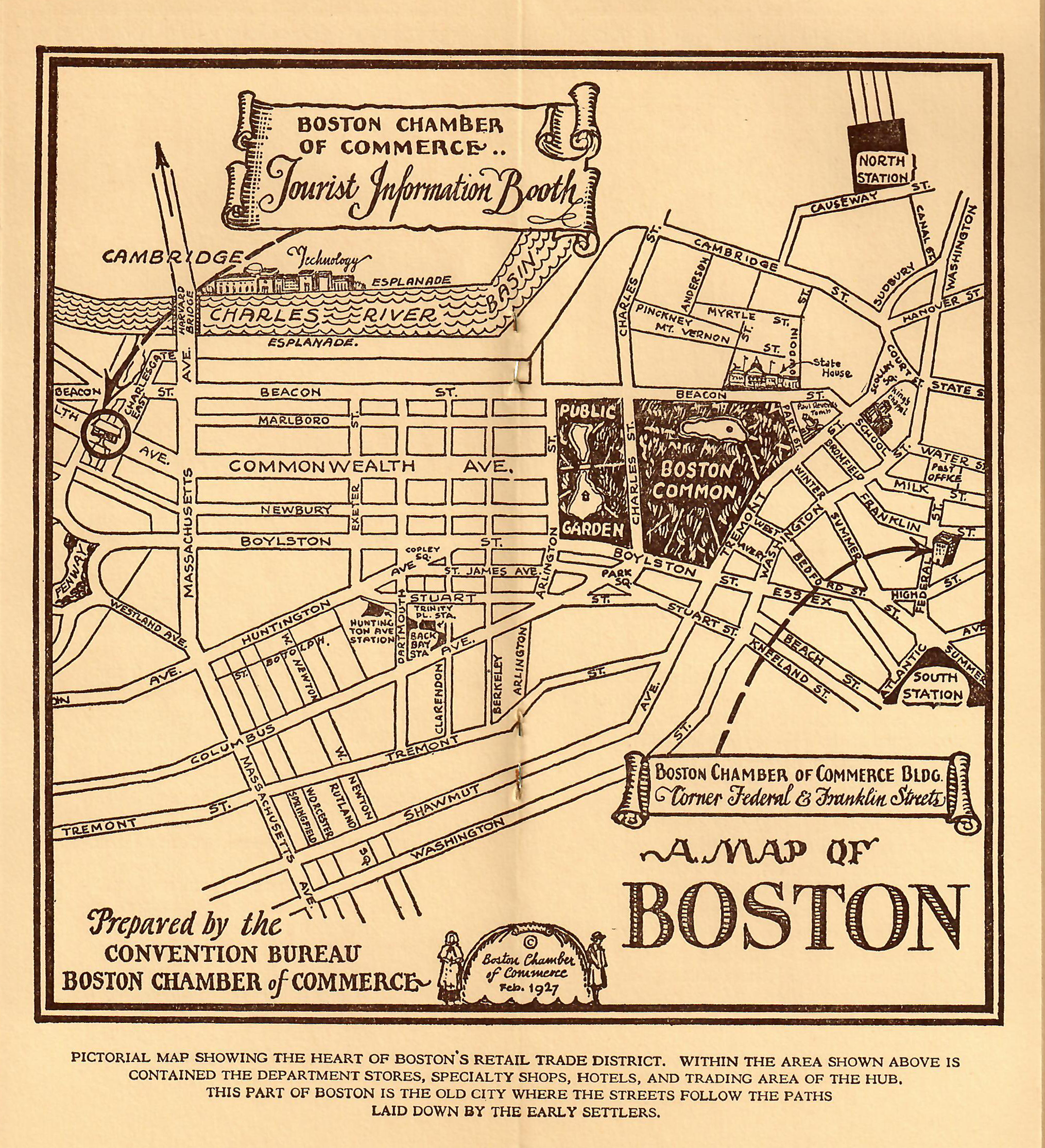
Merchants have long understood Boston history and the opportunity for tourism dollars. In 1927, the “Convention Bureau” put out this early “Then and Now” brochure filled with sites to see along with an attractive map of downtown.

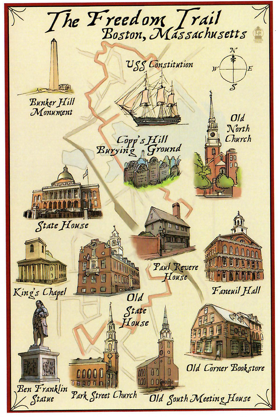
THE FREEDOM TRAIL
Source: Lantern Press

In 1951 a journalist came up with the idea of the self guided Freedom Trail walking tour of the downtown Boston area. You can read about its history on Wikipedia. It was the next attempt to help tourists and residents to understand what things can be seen downtown--namely colonial historical sights. The Boston Freedom Trail is part of a network of “Freedom Trails” up and down the East Coast which document famous spots and events that occurred during the Revolutionary War.
The Freedom Trail tour was designed 70 years ago at a time when walking was encouraged and when cars had yet to reach cluster proportions they are today.
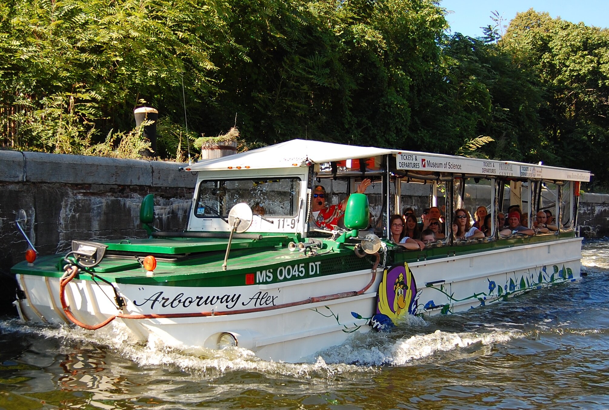
The Duckboats

Once the downtown area was cleaned up, and following the construction of the beautiful Rose Kennedy Greenway (JFK's mother), new types of tours began to appear. DuckBoats, Trolley Tours, Segways, Bike Tours, etc. The DuckBoats, originally founded in 1984, gives over 500,000 individual tours a year (according to their website). I watched them build the forest which is the Greenway several years ago and thought this is a really great idea. People who work downtown now have a place to go enjoy their lunch. Excellent urban planning. I tell tourists that the forest is not a hundred years old. It was not here several years ago. That tourists now roam freely downtown by the thousands in the summer is remarkable compared to the way things were a few decades ago.
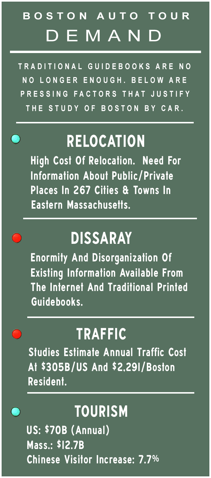
Guidebooks, of which there are many (Fodor, Moon, Lonely Planet, et al), include blurbs about things to consider when you are going somewhere by car. But no particular focus on what you might be able to see while driving in a car is made. There are books about going on road trips or leaf peeping in Vermont by car. But there doesn’t seem to be any analysis of what you can see throughout the greater Boston metro area specifically exploring from the vantage of a car.

South Station
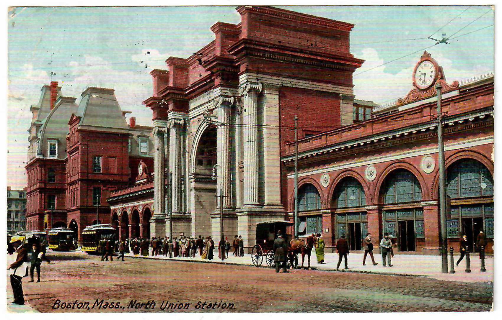
Union Station, Predecessor to the Old Boston Garden
At either end of the Greenway are Boston’s two main train stations, North Station and South Station. People drive past these spots everyday and don’t think anything of it.
Above are secret views of what things looked like in the early 1900s. The predecessor to TD Garden was the original Boston Garden (where I watched Larry Bird as a kid). I’ve learned that there was yet another structure before that existed before that called Union Station. Union and South stations used to be connected by an overhead rail line as seen in the postcard which followed the perimeter of Atlantic Avenue. It was eventually torn down.
Prior to the completion of the Big Dig downtown Boston was not as conducive to tourists as it is today. I’ve mentioned to riders that when I was younger, in the 1970s, I used to feel there was no reason to go downtown unless you worked there or you went to the Aquarium which most people did when they were 8 yrs. old on a class trip. Everything underneath the Central Artery was either a dead zone or a parking lot. Some old timers mentioned they recall a wall with a doorway under the highway that connected Haymarket to Hanover Street which was locked every night at 6pm. Others recall that towards the bottom part of highway downtown, that’s where they used to go to buy fireworks - “under the bridge”.
C. TRAFFIC
“In Boston, if you stop or pause as a courtesy for another driver it is seen as a weakness” - Uber Rider


Why has no one thought to develop a study of the greater Boston area from a car? Well, following the completion of 128/I-95 and the Mass Pike, 60 years ago, as well as the Big Dig and perhaps the rise of the bike friendly and anti-pollution/anti-car movements, there has also arisen a slight problem.
Traffic.
The traffic crisis in Boston has, according to a Globe editorial, reached "epic" proportions. Bostonians don't need to be told this, of course. They know traffic sucks. Boston is now ranked by some studies as having the worst in the country---even worse than LA. We are left to our own devices and to road tripping to figure things out. But few have the time (or stomach) to deal with the maze of bad intersections, rotaries, endless potholes, continuous construction projects, aggressive drivers ... and traffic.
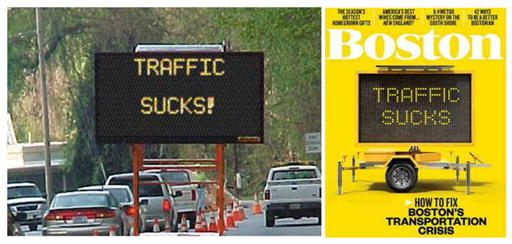
Magazine Cover: Boston Magazine
A Time Lapse video of Google Maps traffic taken over 24 hours in Boston on 9/1/16. Source: YouTube
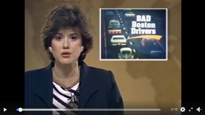
Bad Boston Drivers (Source: WBZ)
D. SEEING THROUGH THE TRAFFIC


“Be color blind. A yellow light (and the first ten seconds of a red light) are considered the funcitonal equivalent of a green light. This goes both ways though, so be careful. But the faster you gun it, the less honks you'll hear.“ - Not For Tourists, Boston Edition (2017)
One could argue that, with the exception perhaps of UPS and Fedex drivers, not since Paul Revere traversed the entire region on his horse has someone been able to navigate hundreds of cities and towns in Eastern Massachusetts, and lived to tell the tale! This is because we no longer fight redcoats, we battle red lights.
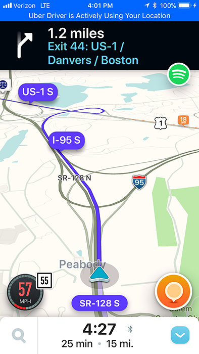
Alas. Several miraculous technology developments over the past decade offer hope. These include: GPS systems such as Waze and Google Maps, and the rideshare apps, Uber and Lyft.
GPS has evolved significantly over the past few years, and it now magically enables drivers to circumvent traffic in order to get to work faster. In fact, GPS systems have become a staple for Uber and Lyft drivers as one does not even need to have mastered the crazy Boston roads to be able to become an expert in how to navigate them.

Waze
There is something else to think about too. GPS can be used strategically to discover what interesting things lay beyond the downtown area. All that is needed is for someone to actually use GPS to drive around the state in order to understand what is out there to see. Easy enough, right? Except the time and money needed to do this. And knowing where to go and what to discover.
In 2018, a blog was created called The Boston Auto Tour. The purpose was to document the 5-year driving journey of an Uber driver to describe what he has seen and heard.

E. FURTHER READING

Source: The History Press
“Existing Guidebooks and Tours: Not Focused On Tourism From a Car” (Boston Auto Tour - Blog Post)
“Why No Auto Tour? A Brief History of Boston Tourism, Pt. 1” (Boston Auto Tour - Blog Post)
America’s Freedom Trail (Alper)
Boston Freedom Trail (Wikipedia)
History Of Boston Roads - Google Search
Massachusetts Historical Society: Massachusetts Maps
Boston’s Central Artery, (2001) Yannis Tsipis, The History Press
The Elevated Central Artery (Boston Globe Archives)
Building The Mass Pike, (2002) Yannis Tsipis, The History Press
History of the Massachusetts Turnpike - Wikipedia
The History of Route 128 | Mark Sardella
Building 128, (2003) David Kruh and Yannis Tsipis, The History Press
a. Route 128 evolved from ad hoc collection of two-lane roads - The Boston Globe
The Dramatic Transformation Of Transportation In Boston (WBZ)
10 Years Later, Did The Big Dig Deliver? (Boston Globe)
Maps and History at BOSTONROADS
Old map scans and highway planning reports covering the Boston and Providence metropolitan areas, Massachusetts and Rhode Island
Boston Post Road Carved out Three Travel Routes through State | ConnecticutHistory.org
The forerunners of Connecticut’s three interstate highways began as rugged postal routes in the 1600s.
The Kings Best Highway (2010, Jaffee) NYT Review
Along Massachusetts’s Route 20 (Till, History Press)
Interstate 695 (Massachusetts) - Wikipedia
Boston's Cancelled Highways - Google Search
All The Highways And Parkways That Never Were | Universal Hub
“Original conception of the Central Artery. You know, of course, about I-695 and I-95 in the city - cancelled after residents from Hyde Park to Somerville raised holy hell and the governor canceled the plans and we got the Orange Line instead. But a 1930 report by the Boston Planning Board (yes, back in the days when Boston had a planning board) proposed a series of new expressways and parkways, pretty much all with the purpose of speeding people downtown - in part through cross-town routes that would take traffic off the major routes downtown. John McLachlan dug up a copy of the report. It's an interesting report, both to look back and see what was built - and what wasn't.”
Massachusetts Route 3 - Wikipedia
US Route 3 Widening - Google Search
State Still Mulling Express Toll Lanes For Route 3 - The Boston Globe
The express lanes are one of three main concepts under study as potential public-private partnerships, along with construction of a third crossing of the Cape Cod Canal and small service plazas at undeveloped highway rest stops and park-and-rides.
Boston Auto Tour: YouTube - Boston Roads
George H. Walker Company, Wikipedia